


Theory of Operation
JS56696,00009F3 1901JUN111/1
Theory of Operation
Surface Water Pro is a two modular program—basic and
advanced. Surface Water Pro (basic program) is designed
for users to create levees and develop basic ditches
in their fields. Surface Water Pro Plus is an advanced
ditching program that generates a “best fit drain”. Surface
Water Pro Plus calculates the most effective drain in a field
while moving the least amount of soil. This information
is generated from vertical GPS signals calculated from
StarFire 3000 or StarFire iTC receivers. Surface Water
Pro Plus requires both a machine and implement receiver
and cannot operate with just an implement receiver.
Levee applications require John Deere RTK, and ditching
requires either SF2 or RTK signal. For greater accuracy,
we highly recommend the RTK solution.
NOTE: For best accuracy, recalibrate benchmark after
power cycling the quick survey and absolute base
station. When starting up the base station, the
point of reference could shift slightly, so for the
highaccuracy user, consider recalibrating.
Operating with an absolute survey base station
reduces the need for benchmarking. In quick
survey mode, anytime the base is moved or
power is cycled, another calibration is required
for high accuracy users.
John Deere implement mounts must be used
because they reduce vibration and minimize
hardware failures. Vibration mounts help
minimize hardware failures over time, especially
in ditching applications.
Record ditches from HIGH TO LOW elevation.
Cut ditches in either direction.
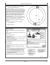
To ensure highest system accuracy, do not operate
Surface Water Pro and Pro Plus outside a ONE
MILE radius of the Base Station.
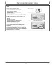
Surface Water Pro features available on the GS3 display
and our Apex Desktop Software provide value by offering
ways to manage your topographic data better and ensure
optimum water distribution for crop production. Apex
Surface Water Pro features allow you to unload your GS3
survey data to generate Depression, Flow Direction, and
Drainage maps utilizing GSDNet. You can also manage
your Ditch and Levee Tracks from year to year by editing
cut, slope, or drop of fall. Additionally, layering your
ditch or levee tracks over your yield data displays your
results from the work you completed. See your local John
Deere Dealer or visit our website www.StellarSupport.com
to learn more about these additional features for your
Surface Water Pro program.
Reprogram receivers (Surface Water Pro Plus) at the
vehicle receiver location. Each receiver must be updated
individually every time a software update is available
[3.20D or older]. You cannot have both receivers attached
to the wiring harness when reprogramming.
IMPORTANT: A StarFire iTC receiver, or newer, is
required for Surface Water Pro.
Surface Water Pro Plus does not support an
Implement Receiver Only configuration. Do
not run ditching with an implement receiver
only—both a Machine & Implement receiver
must be used to operate that software.
Surface Water Pro and Pro Plus Survey
function is NOT compatible with Swath Control
Pro. Do not use the survey function in
conjunction with Swath Control Pro.
Surface Water Pro and Pro Plus is NOT
compatible with iGuide Do not use in
conjunction with iGuide.
101
061611
PN=8