


Survey
Continuedon next page JS56696,00009E01918MAY111/3
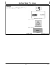
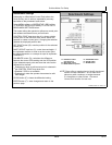
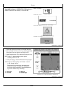
How to Survey a Field
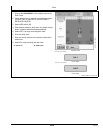
Surface Water Pro provides a Survey tab for the purpose
of performing a field survey. When a survey is performed,
the RCD (GS3) creates a survey file for the field that
contains a collection of data points. Each point represents
a specific latitude and longitude position within the field for
which an elevation value is stored.
The data collected can be valuable to create informational
maps. Any maps created from this data is only as good
as the quality of the data that creates it. In order to create
quality maps from your field survey data, be sure to
perform your field survey to the highest quality. As a start,
please observe the following guidelines as a minimum for
performing a field survey.
1. Use the correct differential correction for your
application. It is recommended an RTK correction
be used for the highest accuracy and quality survey
data. An SF2 correction is allowed for surveying your
fields, but only after consulting your dealer to see if
it is right for your application. An RTK correction is
always utilized for flat to rolling field terrain. Using
an inappropriate differential correction for collecting
elevation data leads to inaccurate maps.
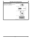
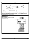
2. Make the first pass very close to the exterior field
boundary, when collecting survey data, to ensure
sufficient data around the perimeter of the field. Make
the second pass around the field boundary but slightly
offset inward from the first pass. Offset the second
pass approximately 15 m (50 ft.).
3. Conducting a thorough survey can be done by
setting up straight track lines and parallel tracking
off them through the field. Set up straight track
lines with intervals depending on the field being
surveyed.
•
Fields with significant elevation changes and slopes
— track spacing of 7.5—15 m (25—50 ft.) is
recommended.
•
Flatter fields — a track spacing of 15 m (50 ft.) is
recommended.
•
Flat to precision leveled ground — a track spacing of
15—30 m (50—100 ft.).
Do not exceed 50 m (164 ft.) track spacing for
surveying purposes.
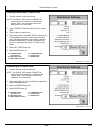
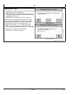
4. Two forms of Survey recording types are available:
•
Distance Base—ideal for low speed surveys and
consistently spaced at userdefined distances.
•
Time Based—suited to higher speed surveying and
the distance between the points varies with the
speed at which the survey is recorded.
5. Ensure that the entire field has been covered. Do not
skip parts of the field because they are inaccessible
due to wet or muddy conditions; you are in a hurry;
you think you do not have time to finish properly. This
has a negative impact on the quality of your maps
generated from your collected data. It is important to
cover the entire field.
6. It is also a good idea to survey the bottom of existing
ditches within the field, and at a minimum ditches with
measurable width and depth. Utilizing parallel tracking
with straight track can cause the user to miss areas
of interest for surveying, for example the bottom of
a main ditch which can have measurable width and
depth.
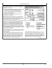
Survey Mode is designed to allow an operator to collect
elevation and position data as a separate operation. From
this data, topographical information can be created and
displayed. The accuracy level while surveying determines
the accuracy of the topographical maps. Elevation
data points can also be obtained for log files created
while performing field operations such as planting and
combining.
NOTE: Survey Modeis notallowed withSwath ControlPro.
351
061611
PN=31