


Ridge Tool Company
25
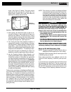
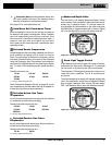
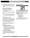
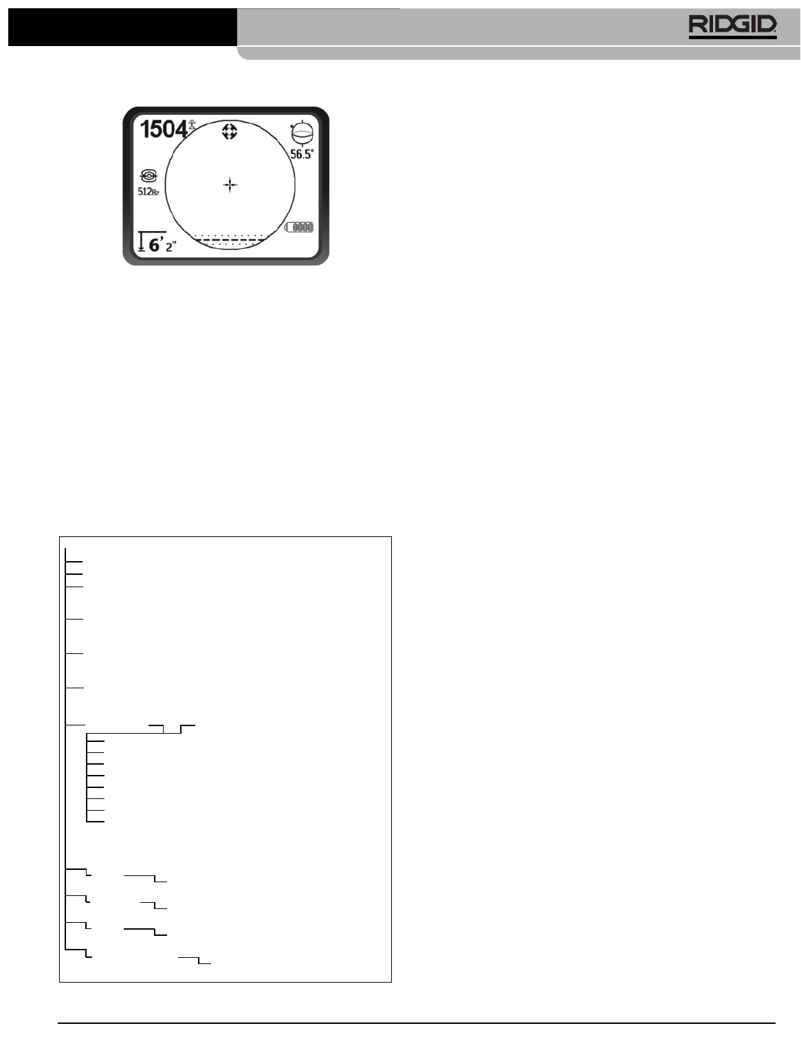
Figure 47 – Defaults Restored (Sonde Mode)
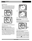
Pressing the Menu Key without changing either check-
box will exit the option and leave things as they were.
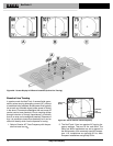
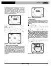
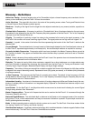
Menu Tree
The following graphic shows the options and controls
built into the NaviTrack II menus. Pressing the Menu Key
from the active screen moves the display to the top of
the menu tree. Move through the choices using the Up
and Down Keys. Pressing the Select Key when any
choice is highlighted will show that sub-menu. Pressing
the Menu Key within a sub-menu will move up one
level. Checkboxes are turned on and off by pressing the
Select Key.
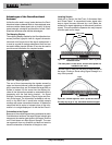
A Better Way of Locating
The NaviTrack II gives the operator a picture of the sit-
uation as the receiver moves along the target area and
makes it easier to understand where a target line’s
electromagnetic field is. With more complete information,
an operator can understand how things stand under-
ground and resolve complex situations, avoid inaccurate
mark-ups, and find the right line or cable more rapidly.
What the NaviTrack II Does
The NaviTrack II is used above ground to sense and
trace electromagnetic fields emitted from underground or
hidden lines (electrical conductors like metal wires and
pipes) or Sondes (actively transmitting beacons).
When the fields are undistorted, the information from the
sensed fields gives an accurate picture of the buried ob-
ject. When the situation is made complex by interfer-
ence from more than one line, or other factors, the
NaviTrack II provides a display of information that show
multiple measurements of the detected field. This data can
make it easier to understand where the problem is, by pro-
viding clues as to whether a locate is good or bad, ques-
tionable or reliable. Instead of just laying paint in the
wrong place, the operator can see clearly when a difficult
locate needs re-evaluation.
The NaviTrack II provides more of the critical information
the operator needs to understand the situation of the util-
ity being located.
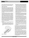
What It Does Not Do
The NaviTrack II locates by sensing electromagnetic
fields surrounding conductive objects; it does not sense
the underground objects directly. It provides more infor-
mation about the shape, orientation, and direction of
fields than other locators but it does not magically interpret
that information or provide an x-ray image of under-
ground objects.
A distorted, complex field in a noisy environment re-
quires intelligent human thought to analyze correctly.
The NaviTrack II cannot change the results of a difficult lo-
cate, even though it shows all the information about
those results. Using what the NaviTrack II shows, a good
operator can improve locating results by “making the cir-
cuit better” (change frequency, ground, or the transmitter’s
location on the target line.)
NaviTrack
®
II
Activated Frequencies
Sonde Selected Frequencies
Line Trace Selected Frequencies
Power (Passive Trace) Selected Frequencies
No-Signal Indicator
Sonde
16 Hz, 512 Hz, 640 Hz, 850 Hz, 8kHz
16 kHz, 33 kHz
Information Menu
Restore Default Settings
(Check Yes/No)
Trace Mode
Units of Measure
Feet/Meters
Backlight Options
On/Off/Auto
LCD Contrast
Increase/Decrease
Display Elements Select (Check On/Off)
Sonde Mode
Watermark
Sound Signals
Center Signal Strength*
Signal Strength
Angle Indicator
Mute > 99'
Tracing Lines*
* = Line Trace Display Only
Frequency Select (Check On/Off)
Line Trace
128 Hz, 1 kHz, 8 kHz, 33 kHz,
200 kHz, 262 kHz
Power
50 Hz, 60 Hz