


37
Polar Alignment
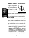
The great majority of ETX-80AT owners will find it
unnecessary ever to Polar align the telescope.With
these ETX telescope models the standard-equip-
ment Autostar controller allows the telescope to be
used in the altazimuth (Alt/Az) orientation for all
observing purpose.This section is included only for
educational pur
poses, where the observer might
wish to operate the analog setting circles
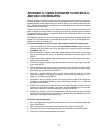
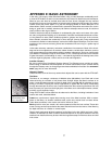
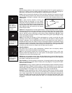
(Fig. 28
and Fig.
29)
in place of the digital setting circles
built into the Autostar hand controller. Absent a
desire to use the analog circles or simply to be
informed about the use of the equatorial (Polar-
aligned) mount, reading of this appendix ma
y be
omitted.
In P
olar Alignment, the telescope is oriented so that the horizontal and vertical axes of the tele-
scope are lined up with the celestial coordinate system.
Polar Alignment requires the telescope
to be mounted to the optional #884 Deluxe Field Tripod .
In order to Polar align your telescope, it is essential to have an understanding of how and where
to locate celestial objects as they move across the sky.This section provides a basic introduc-
tion to the terminology of Polar-aligned astronomy, and includes instructions for finding the
celestial pole and for finding objects in the night sky using Declination and Right Ascension.
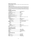
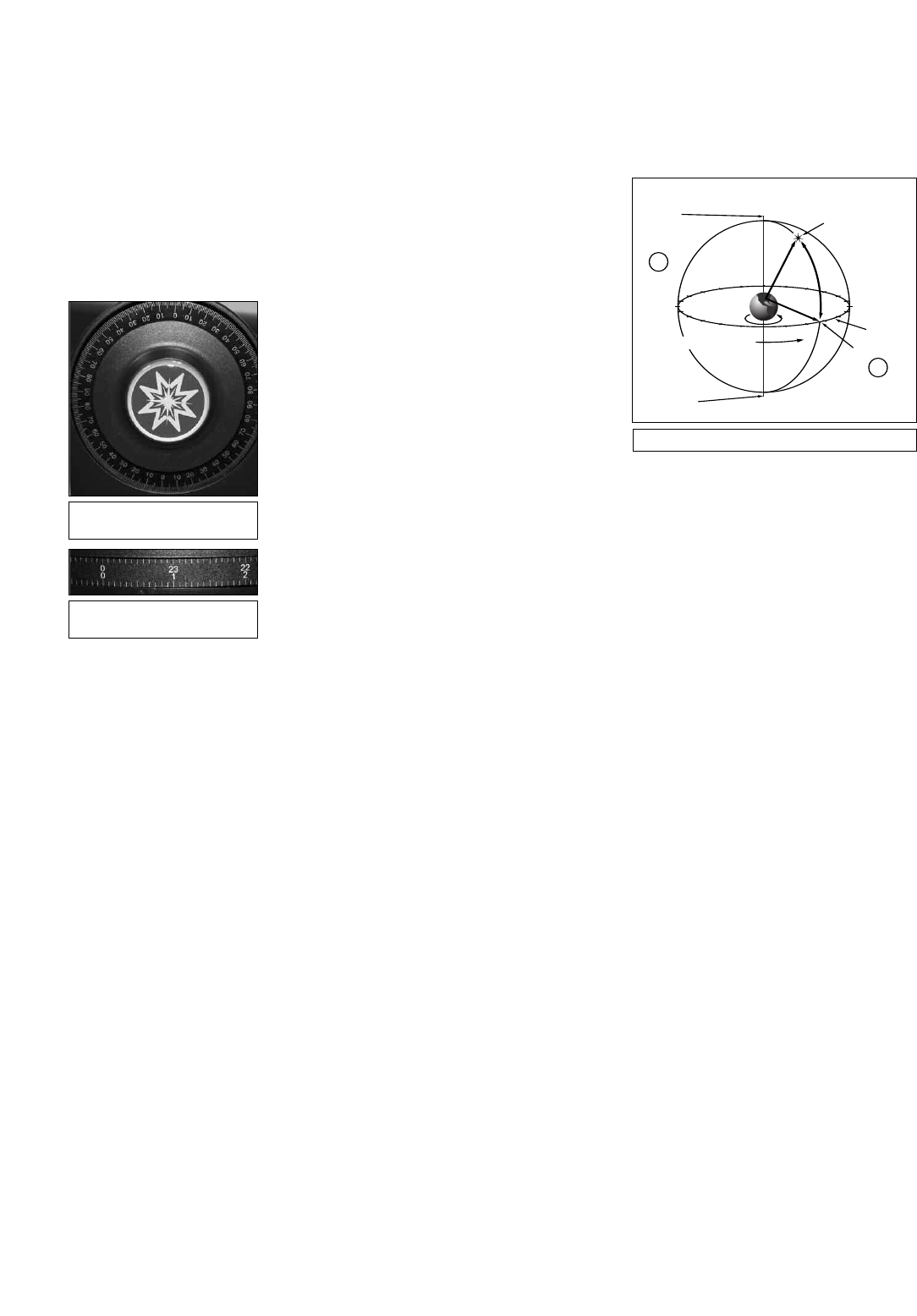
Celestial Coordinates
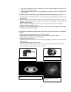
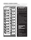
Celestial objects are mapped according to a coordinate system on the Celestial Sphere (Fig. 30),
an imaginary sphere surrounding Earth on which all stars appear to be placed. This celestial object
mapping system is analogous to the Earth-based coordinate system of latitude and longitude.
The poles of the celestial coordinate system are defined as those two points where the Earth’s
rotational axis, if extended to infinity, North and South, intersect the celestial sphere. Thus, the
North Celestial Pole (1, Fig. 30) is that point in the sky where an extension of the Earth’s axis
through the North Pole intersects the celestial sphere. This point in the sky is located near the
North Star, Polaris.
In mapping the surface of the Earth, lines of longitude are drawn between the North and South
Poles. Similarly, lines of latitude are drawn in an East-West direction, parallel to the Earth’s
Equator.The Celestial Equator (
2, Fig. 30) is a projection of the Earth’s Equator onto the celes-
tial sphere.
Just as on the surface of the Earth, in mapping the celestial sphere, imaginary lines have been
drawn to form a coordinate grid. Thus, object positions on the Earth’s surface are specified by
their latitude and longitude
. For example, you could locate Los Angeles, California, by its lati-
tude (+34°) and longitude (118° West); similarly, you could locate the constellation Ursa Major
(which includes the Big Dipper) by its general position on the celestial sphere:
R.A.:
11hr; Dec: +50°.
•
Right Ascension: The celestial analog to Earth longitude is called “Right Ascension,” or
“R.A.,
”
and is measured in time on the 24 hour
“clock” and shown in hours or “hr," minutes
or “min," and seconds or “sec," from an arbitrarily defined “zero” line of Right Ascension
passing through the constellation Pegasus. Right Ascension coordinates range from 0hr
0min 0sec to 23hr 59min 59sec. Thus there are 24 primary lines of R.A., located at 15
degree intervals along the celestial equator. Objects located further and further East of the
prime Right Ascension grid line, 0hr 0min 0sec, carry increasing R.A. coordinates.
•
Declination: The celestial analog to Earth latitude is called Declination, or “Dec,” and is
measured in degrees, arc-minutes and arc-seconds, e.g., 15° 27' 33". Declination shown
as North of the celestial equator is indicated with a “+” sign in front of the measurement,
1
4
15
1
6
17
18
1
9
20
2
1
22
2
3
0
1
12
1
1
10
9
8
7
5
6
4
3
2
1
3
Earth’s
Rotation
0 Dec.
South
C
elestial
Pole
Right Ascension
S
tar
Celestial
Equator
-90 Dec.
+90 Dec.
North
Celestial
P
ole
(Vicinity
of Polaris)
D
e
c
l
i
n
a
t
i
o
n
1
2
Fig. 30: Celestial Sphere.
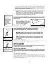
Fig. 28:
Declination setting
circle.
Fig. 29:
Right Ascension
setting circle.
APPENDIX B: EQUATORIAL (POLAR) ALIGNMENT