


PRIMUS
R
660 Digital Weather Radar System
A28–1146–111
REV 2 5-37
Radar Facts
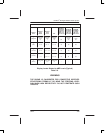
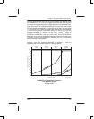
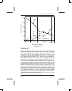
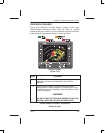
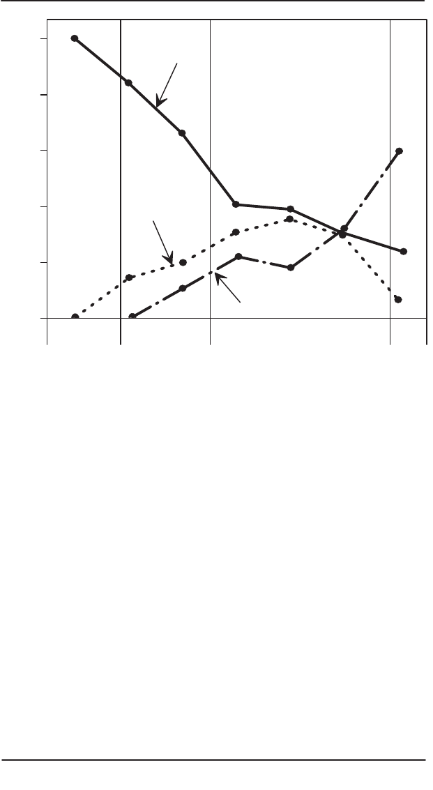
RELATIVE FREQUENCY
60%
40%
20%
0%
80%
100%
1/2” HAIL
1/4” HAIL
3/4” AND LAGER HAIL
AD–15358–R1@
LEVEL 2
YELLOW
LEVEL 3
RED
LEVEL 4
MAGENTA
Hail Size Probability
Figure 5–33
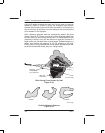
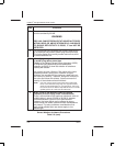
Spotting Hail
As previously stated, dry hail is a poor reflector, and therefore
generates deceptively weak or absent radar returns. When flying above
the freezing level, hail can be expected in regions above and around wet
storm cells found at lower altitudes. The hail is carried up to the
tropopause by strong vertical winds inside the storm. In large storms,
these winds can easily exceed 200 kt, making them very dangerous.
Since the core of such a storm is very turbulent, but largely icy, the red
core on the radar display is weak or absent and highly mobile. The
storm core can be expected to change shapes with each antenna scan.
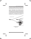
On reaching the tropopause, the hail is ejected from the storm and falls
downward to a point where it is sucked back into the storm. When the hail
falls below the freezing level, however, it begins to melt and form a thin
surface layer of liquid detectable by radar. A slight downward tilt of the
antenna toward the warmer air shows rain coming from unseen dry hail
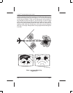
that is directly in the flightpath, as shown in figure 5–34. At lower altitudes,
the reverse is sometimes true. The radar can be scanning below a rapidly
developing storm cell, that the heavy rain droplets have not had time to
fall through the updrafts to the flight level. Tilting the antenna up and down
regularly produces the total weather picture.