


PRIMUS
R
660 Digital Weather Radar System
A28–1146–111
REV 2
Radar Facts
5-26
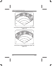
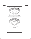
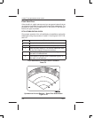
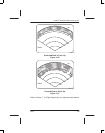
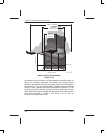
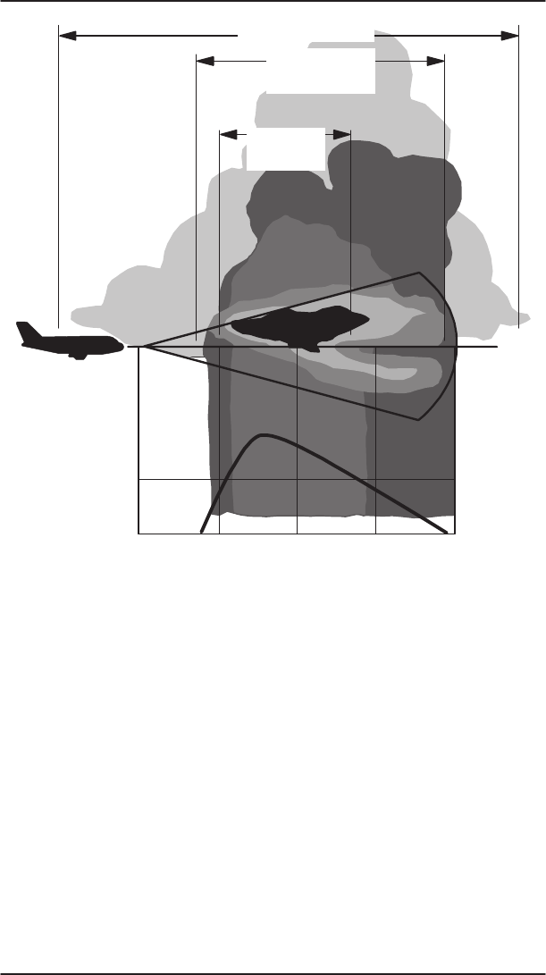
RED LEVEL*
NAUTICAL MILES
RAINFALL RATE
60 8040200
VISIBLE CLOUD MASS
RAIN AREA
(ONLY THIS IS
VISIBLE ON RADAR)
RED ZONE
WITHIN
RAIN AREA
AD–12057–R3@
Radar and Visual Cloud Mass
Figure 5–29
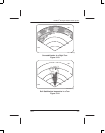
As masses of warm, moist air are hurled upward to meet the colder air
above, the moisture condenses and builds into raindrops heavy
enough to fall downward through the updraft. When this precipitation is
heavy enough, it can reverse the updraft. Between these downdrafts
(shafts of rain), updrafts continue at tremendous velocities. It is not
surprising, therefore, that the areas of maximum turbulence are near
these interfaces between updraft and downdraft. Keep these facts in
mind when tempted to crowd a rain shaft or to fly over an
innocent–looking cumulus cloud.