


Section 1. Preparation and Siting
1-5
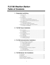
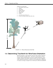
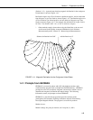
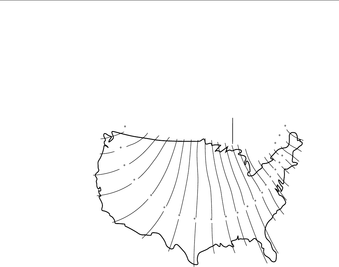
(Section 1.4.1). A general map showing magnetic declination for the contiguous
United States is shown in Figure 1.4-1.
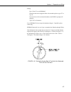
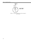
Declination angles east of True North are considered negative, and are subtracted
from 0 degrees to get True North as shown Figure 1.4-2. Declination angles west
of True North are con-sidered positive, and are added to 0 degrees to get True
North as shown in Figure 1.4-3. For example, the declination for Logan, Utah is
16° East. True North is 360° - 16°, or 344° as read on a compass.
* Other methods employ observations using the North Star or the sun, and
are discussed in the Quality Assurance Handbook for Air Pollution
Measurement Systems, Volume IV - Meteorological Measurements
4
.
Subtract declination from 360° Add declination to 0°
FIGURE 1.4-1. Magnetic Declination for the Contiguous United States
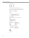
1.4.1 Prompts from GEOMAG
GEOMAG is accessed by phone with a PC and telephone modem, and a
communications program such as GraphTerm (PC208 Software). GEOMAG
prompts the caller for site latitude, longitude, and elevation, which it uses to
determine the magnetic declination and annual change. The following
information, menu, and prompts are from GEOMAG:
GEOMAG is a user-friendly program that provides estimates of the
geomagnetic field elements, including declination and total field intensity,
based upon Magnetic Models. The program is accessible by modem.
Modem Access:
Modem settings: No parity, 8 data bits, and 1 stop bit (i.e., N81)