


4-3
190-01122-03 Rev. A
GDL 88 ADS-B Transceiver Pilot’s Guide
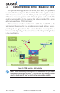
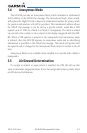
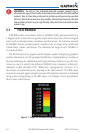
Selected
Traffic Info
ADS-B and TCAS
Status and Altitude
Filter
Touch To View
Traffic Menu
Selected Vector
Motion and Duration
Touch For
Next Target
Map
Orientation
Ownship
Icon
Traffic Display
Radius
Traffic Motion
Vector (Green)
Proximate
Non-Directional
Traffic
* Indicates Multiple Targets. Touch the target to show all
targets. Then touch next to get info on each of the targets.
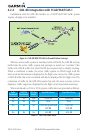
Figure 4-2 AIRB Display with the GTN 7XX
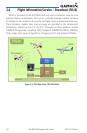
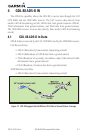
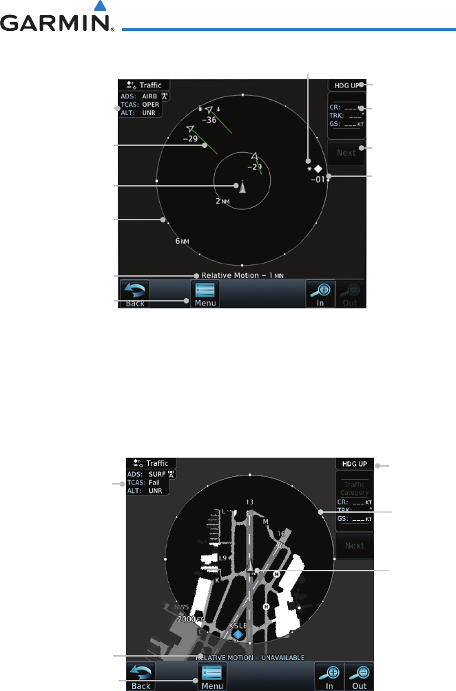
SURFisinoperationwithintheterminalenvironment(withinveNMand
lessthan1,500feetaboveeldelevation).WhenSURFisrunning,andthezoom
scaleonthetrafcdisplayislessthantwoNM,theairportenvironment(including
taxiways and runways) will be displayed in addition to traffic. This is to aid in
situational awareness of runway occupancy/availability, etc.
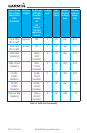
ADS-B and
TCAS Status and
Altitude Filter
Touch To View
Traffic Menu
Selected Vector
Motion and Duration
Map
Orientation
Ownship
Icon
Traffic
Display
Radius
Figure 4-3 SURF Display with the GTN 7XX
DuetothevaryingprecisionofthedatathatmaybereceivedviaADS-B,ADS-R,
andTIS-B,alltrafctargetsmaynotbedepictedonthetrafcdisplay.Because
higher data precision is required for display in the SURF environment, some