PRIMUS
r
880 Digital Weather Radar System
A28--1146--102--01
REV 1
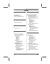
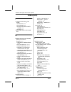
Index
Index--3
Index (cont)
range, 3-18
SECT (scan sector), 3-16
SLV (slave), 3-19
STB (stabilization), 3-17
TGT (target), 3-16
Tilt, 3-16
TRB (turbulence detection),
3-17
WI--880 Weather radar indicator
operation, 3-1
AZ (azimuth), 3-8
BRT (brightness) or BRT/LSS
(lightning sensor system),
3-9
display area, 3-2
function switch, 3-3
gain, 3-10
range, 3-8
RCT (rain echo attenuation
compensation technique),
3-7
SCT (scan sector), 3-8
STAB (stabilization), 3-7
target alert characteristics,
3-7
TGT (target), 3-6
tilt, 3-9
TRB (turbulence), 3-8
P
Pitch and roll trim adjustments, 5-19
Preliminary control s ettings, 4-1
Radar mode ---- ground mapping,
4-6
power--up procedure, 4-1
radar mode -- -- weather, 4-4
standby, 4-4
Procedures
in--flight roll offset adjustment
procedure, 5-26
pitch gain adjustment, 5-30
pitch offset adjustment
procedure, 5-28
PRIMUS
R
880 power--up
procedure, 4-2
roll gain adjustment, 5-29
severe weather avoidance
procedures, 5-60
stabilization in straight and level
flight check procedure, 5-21
stabilization in turns check
procedure, 5-23
R
Radar facts
additional comments, 5-68
turbulence versus distance
from storm core, 5-68
turbulence versus distance
from storm edge, 5-68
configurations of individual
echoes (Northern Hemisphere),
5-60
avoid all crescent shaped
echoes by 20 miles, 5-64
avoid hook echoes by 20
miles, 5-60
avoid pendant by 20 miles,
5-63
avoid steep rain gradients by
20 miles, 5-64
avoid V-- notch by 20 miles,
5-62
ground mapping, 5-69
interpreting weather radar
images, 5-31
line configurations, 5-65
avoid bow--shaped line of
echoes by 20 miles, 5-67
avoid line echo wave patterns
(LEWP) by 20 miles, 5-66
avoid thunderstorm echoes at
the south end of a line or at
abreakinalineby20
miles, 5-65
radar operation, 5-1
radome, 5-54


