


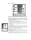


- 16 -
configuration the observer does not need to press the Arrow keys of the Electronic Controller in order to
track celestial objects. However, the Arrow keys of the Electronic Controller are useful in this configuration
to enable the centering of objects within the telescopic field or, for example, to move the telescope over the
surface of the Moon or through a large star field.
Celestial Coordinates
Before polar aligning your ETX model, it is helpful to understand how to locate celestial objects as they
move across the sky.
A celestial coordinate system was created that maps an imaginary sphere surrounding the Earth upon which
all stars appear to be placed. This mapping system is similar to the system of latitude and longitude on Earth
surface maps.
In mapping the surface of the Earth, lines of longitude are drawn between the North and South Poles and
lines of latitude are drawn in an East-West direction, parallel to the Earth’s equator. Similarly, imaginary lines
have been drawn to form a latitude and longitude grid for the celestial sphere. These lines are known as
Right Ascension and Declination.
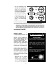
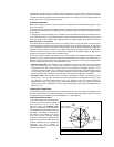
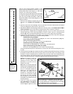
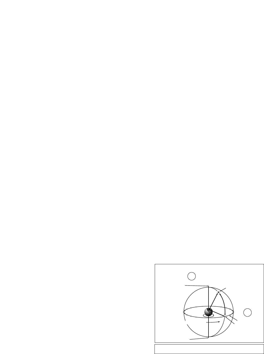
The celestial map also contains two poles and an equator just like a map of the Earth. The poles of this
coordinate system are defined as those two points where the Earth’s north and south poles (i.e., the Earth's
axis), if extended to infinity, would cross the celestial sphere. Thus, the North Celestial Pole (1, Fig. 13) is
that point in the sky where an extension of the North Pole intersects the celestial sphere. The North Star,
Polaris is located very near the North Celestial Pole (1, Fig. 13). The celestial equator (2, Fig. 13) is a
projection of the Earth’s equator onto the celestial sphere.
So just as an object's position on the Earth’s surface can be located by its latitude and longitude, celestial
objects may also be located using Right Ascension and Declination. For example, you could locate Los
Angeles, California, by its latitude (+34°) and longitude (118°). Similarly, you could locate the Ring Nebula
(M57) by its Right Ascension (18hr) and its Declination (+33°).
• Right Ascension (R.A.): This celestial version of longitude is measured in units of hours (hr), minutes
(min), and seconds (sec) on a 24-hour "clock" (similar to how Earth's time zones are determined by
longitude lines). The "zero" line was arbitrarily chosen to pass through the constellation Pegasus — a sort
of cosmic Greenwich meridian. R.A. coordinates range from 0hr 0min 0sec to 23hr 59min 59sec. There
are 24 primary lines of R.A., located at 15-degree intervals along the celestial equator. Objects located
further and further East of the zero R.A. grid line (0hr 0min 0sec) carry higher R.A. coordinates.
• Declination (Dec.): This celestial version of latitude is measured in degrees, arc-minutes, and arc-
seconds (e.g., 15° 27' 33"). Dec. locations north of the celestial equator are indicated with a plus (+) sign
(e.g., the Dec. of the North celestial pole is +90°). Dec. locations south of the celestial equator are
indicated with a minus (–) sign (e.g., the Dec. of the South celestial pole is –90°). Any point on the celestial
equator (such as the the constellations of Orion, Virgo, and Aquarius) is
said to have a Declination of zero,
shown as 0° 0' 0."
Locating the Celestial Pole
To get basic bearings at an observing location, take note of where the sun rises (East) and sets (West) each
day. After the site is dark, face North by pointing your left shoulder toward the direction where the sun set.
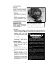
To point at the pole, find Polaris by using the Big Dipper as a guide (Fig. 14).
Polar Alignment Procedure
As the Earth rotates once on its axis every
24 hours, astronomical objects appear to
move across the sky in an arc. This
apparent motion (see SIDEREAL RATE,
page 13) is not obvious to the unaided eye,
but viewed through a telescope such as the
ETX-90EC, ETX-105EC, or ETX-125EC,
this motion is rapid indeed. If the motor
drive has not been engaged, objects
centered in the telescope’s eyepiece move
entirely out of the field of view in 30 to 160
seconds, depending on the magnification
employed. For easy tracking of
astronomical objects your ETX telescope
should be polar aligned.
14
15
16
17
18
19
20
21
22
23
0
1
12
11
10
9
8
7
5
6
4
3
2
13
Earth’s
Rotation
0° Dec.
South Celestial Pole
Right Ascension
Star
Celestial Equator
-90° Dec.
+90° Dec.
North Celestial Pole
(Vicinity of Polaris)
D
e
c
l
i
n
a
t
i
o
n
Fig. 13: The Celestial Sphere.
2
1