


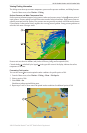


14 XM WX Satellite Weather
®
and XM
®
Satellite Radio Supplement
Appendix
Appendix
Weather Data Warranty
THE WEATHER DATA SOFTWARE PRODUCT IS PROVIDED “AS IS.” ALL OTHER WARRANTIES,
EXPRESSED OR IMPLIED, INCLUDING ANY WARRANTY OF MERCHANTABILITY OR FITNESS
FOR A PARTICULAR PURPOSE OR OF NON-INFRINGEMENT ARE HEREBY EXCLUDED.
USER SAFETY
If you use XM Services it is your responsibility to exercise prudent discretion and observe all safety measures
required by law and your own common sense. You assume the entire risk related to your use of the Services.
XM and Garmin assume no responsibility for accidents resulting from or associated with use of the Services.
Your Radio Service includes trafc and weather information, and you acknowledge that such information is
not for “safety for life”, but is merely supplemental and advisory in nature, and therefore cannot be relied upon
as safety-critical in connection with any aircraft, sea craft or automobile usage. This information is provided
“as is” and XM and Garmin disclaim any and all warranties, express and implied, with respect thereto
or the transmission or reception thereof. XM and Garmin further do not warrant the accuracy, reliability,
completeness or timeliness of the trafc and weather information disclosed on the Radio Service. In no event
will XM and Garmin, their data suppliers, service providers, marketing/distribution, software or Internet
partners or hardware manufacturers be liable to you or to any third party for any direct, indirect, incidental,
consequential, special, exemplary or punitive damages or lost prots resulting from use of or interruptions in
the transmission or reception of the Services.
LIMITS ON OUR RESPONSIBILITY
a) DISCLAIMERS.
EXCEPT AS EXPRESSLY PROVIDED HEREIN, WE MAKE NO WARRANTY OR REPRESENTATION,
EITHER EXPRESS OR IMPLIED, REGARDING THE RADIO SERVICE. YOUR USE OF THE
SERVICE IS AT YOUR SOLE RISK. THE CONTENT AND FUNCTIONALITY OF THE SERVICE IS
PROVIDED “AS IS” WITHOUT ANY WARRANTY OF ANY KIND, EXPRESS OR IMPLIED. ALL SUCH
WARRANTIES OR REPRESENTATIONS (INCLUDING, WITHOUT LIMITATION, THE IMPLIED
WARRANTIES OF MERCHANTABILITY, FITNESS FOR A PARTICULAR PURPOSE, TITLE AND
NON-INFRINGEMENT) ARE HEREBY DISCLAIMED.
b) LIMITATIONS OF LIABILITY.
WE ARE NOT RESPONSIBLE FOR ANY SPECIAL, INCIDENTAL, OR CONSEQUENTIAL
DAMAGES OR LOSSES RELATING TO THE USE OF THE RADIO SERVICE, WHETHER BASED ON
NEGLIGENCE OR OTHERWISE. OUR TOTAL LIABILITY TO YOU AND ANY OTHER PERSONS
RECEIVING OUR SERVICES, REGARDLESS OF THE CAUSE, WILL IN NO EVENT EXCEED THE
AMOUNTS THAT YOU HAVE PAID TO US FOR THE SERVICE THAT YOU RECEIVED DURING
THE SIX (6) MONTH PERIOD IMMEDIATELY PRIOR TO THE SPECIFIC EVENT THAT GAVE RISE
TO THE APPLICABLE DAMAGE OR LOSS. THIS ALLOCATION OF RISK IS REFLECTED IN OUR
PRICES. YOU MAY HAVE GREATER RIGHTS THAN DESCRIBED ABOVE UNDER YOUR STATE’S
LAWS.
This product was developed using DAFIF
™
, a product of the National Geospatial-Intelligence Agency.
This product has not been endorsed or otherwise approved by the National Geospatial-Intelligence Agency, or
the United States Department of Defense (10 U.S.C. 425).
a. Under 10 U.S.C. 456, no civil action may be brought against the United States on the basis of the content of
a navigational aid prepared or disseminated by either the former Defense Mapping Agency (DMA), National
Imagery and Mapping Agency (NIMA), or the National Geospatial-Intelligence Agency (NGA).
b. The DAFIF
™
product is provided “as is,” and no warranty, express or implied, including, but not limited to
the implied warranties of merchantability and tness for particular purpose or arising by statute or otherwise
in law or from a course of dealing or usage in trade, is made by NGA as to the accuracy and functioning of the
product.
c. Neither NGA nor its personnel will be liable for any claims, losses, or damages arising from or connected
with the use of this product. The user agrees to hold harmless the United States National Geospatial-